Clione

Oxford RoboCar Dataset

Unverified
  • December 17, 2025, 02:20 AM
  • December 17, 2025, 02:19 AM
  • December 13, 2025, 06:41 PM
  • November 27, 2025, 06:53 PM
  • October 17, 2025, 11:35 AM
Last updated
Unknown
Release date
November 29, 2016
Size
20000000 samples | 23150.0 GB
License
CC BY-NC-SA 4.0
Tags
driving
autonomous vehicles
diverse driving conditions

Autonomous vehicle research is critically dependent on vast quantities of real-world data for development, testing and validation of algorithms before deployment on public roads. However, few research groups can manage the costs of developing and maintaining a suitable autonomous vehicle platform, regular calibration and data collection procedures, and storing and processing the collected data. Following the benchmark-driven approach of the computer vision community, a number of vision-based autonomous driving datasets have been released, notably the KITTI and Cityscapes datasets. Neither of these datasets address the challenges of long-term autonomy: chiefly, localisation in the same environment under significantly different conditions and mapping in the presence of structural change over time.

The dataset was collected by Oxford University’s Oxford Robotics Institute.

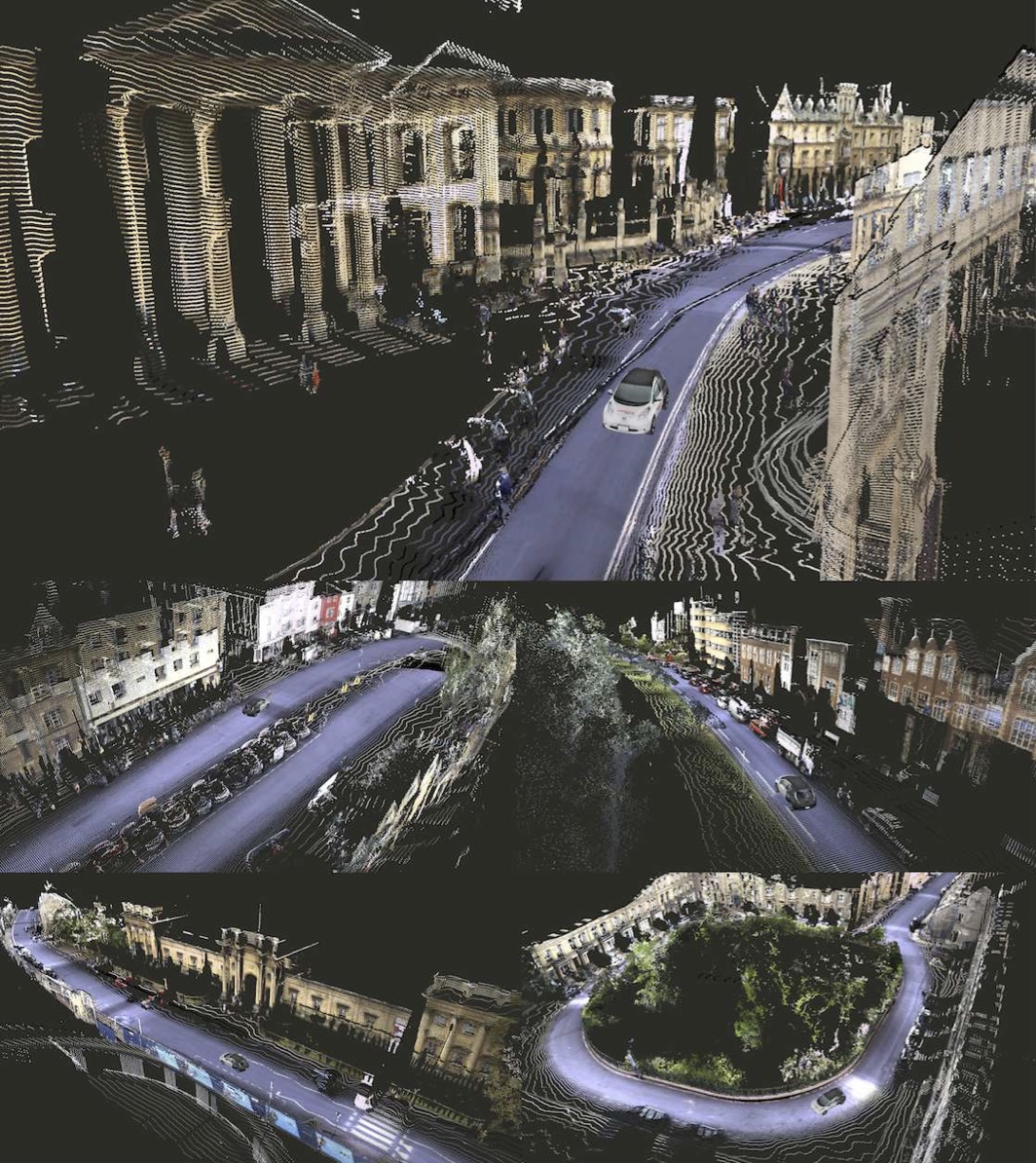
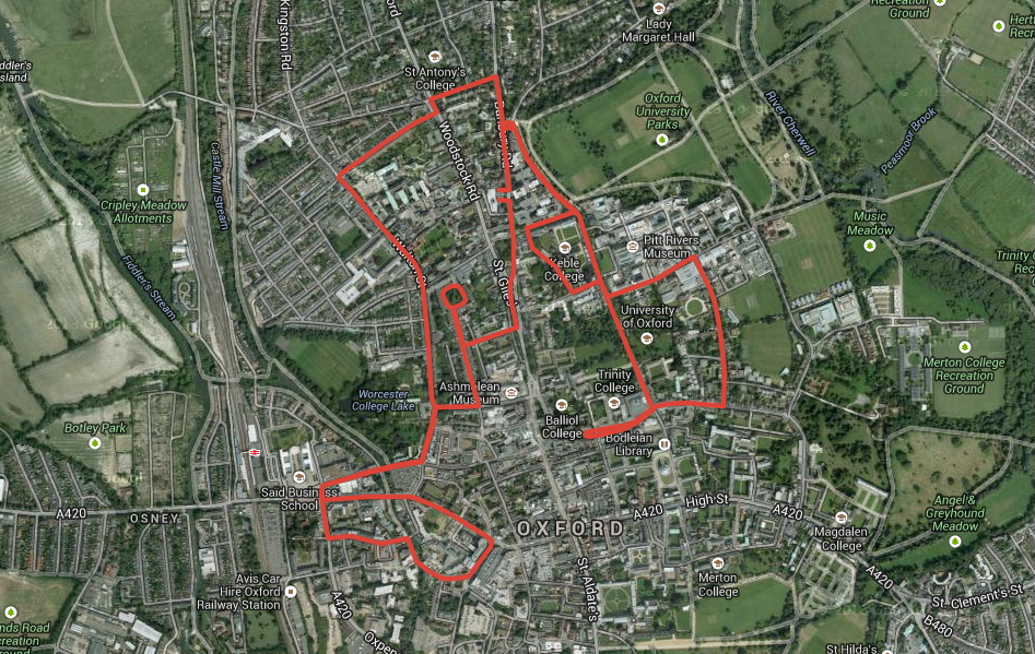
The Oxford RobotCar Dataset contains over 100 repetitions of a consistent route through Oxford, UK, captured over a period of over a year. The dataset captures many different combinations of weather, traffic and pedestrians, along with longer term changes such as construction and roadworks.

Over the period of November 2014 to December 2015 the authors traversed a 10km route through central Oxford twice a week on average in the Oxford RobotCar platform, an autonomous Nissan LEAF. This resulted in approximately 1000km of recorded driving with over 20 million images collected from 6 cameras mounted to the vehicle, along with LIDAR, GPS and INS ground truth. Data was collected in all weather conditions, including heavy rain, nighttime, direct sunlight and snow, and road and building works over the period of a year significantly changed sections of the route from the beginning to the end of data collection. By frequently traversing the same route over the period of a year they enable research investigating long-term localisation and mapping for autonomous vehicles in real-world, dynamic urban environments. Road and building works over the period of a year significantly changed sections of the route from the beginning to the end of data collection.

Oxford RoboCar Dataset

Modality
image
Format
PNG
CSV
Data collection
Timeframe 05/2014-12/2015
Location Oxford, England, United Kingdom
Source
Author
Will Maddern
Geoffrey Pascoe
Chris Linegar
Paul Newman
Institution
University of Oxford
Contact
robotcardataset@robots.ox.ac.uk

Citation

                        @article{RobotCarDatasetIJRR,
  author = {Will Maddern and Geoff Pascoe and Chris Linegar and Paul Newman},
  doi = {10.1177/0278364916679498},
  eprint = {http://ijr.sagepub.com/content/early/2016/11/28/0278364916679498.full.pdf+html},
  journal = {The International Journal of Robotics Research (IJRR)},
  number = {1},
  pages = {3-15},
  pdf = {http://robotcar-dataset.robots.ox.ac.uk/images/robotcar_ijrr.pdf},
  title = {{1 Year, 1000km: The Oxford RobotCar Dataset}},
  url = {http://dx.doi.org/10.1177/0278364916679498},
  volume = {36},
  year = {2017}
}


Example usage

Similar datasets


Clione is an open repository for transparent dataset sourcing, supporting responsible research in robotics and machine learning.
Our mission is to make finding and understanding datasets easy and intutive.

About FAQs Contact